Not so fast.
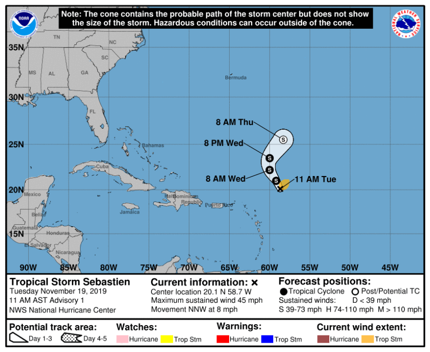
Tropical Storm Sebastien has formed in the Atlantic, meaning folks who thought we were going to coast into the end of the 2019 Atlantic hurricane season will likely have to wait for a few more days.
According to the National Hurricane Center, the storm formed about 275 miles northeast of the Leeward Islands with maximum sustained winds of 45 mph with higher gusts.
It’s moving north-northwest at 8 mph, and forecasters say it will turn to the north on Wednesday and eventually speed to the northeast later Wednesday night.
It could further strengthen, but forecasters expect it to move away from land while being absorbed by a cold front as an extratropical cyclone by Thursday.
“By Wednesday, the cyclone should turn north, and then should accelerate northeastward by Wednesday night as the cyclone gets caught up in the flow between the retreating ridge and ahead of the approaching cold front,” according to Tuesday morning’s Hurricane Center forecast discussion.
Meaning, its biggest impact will be as a talking point with 11 days remaining until the officials “end” of hurricane season.


