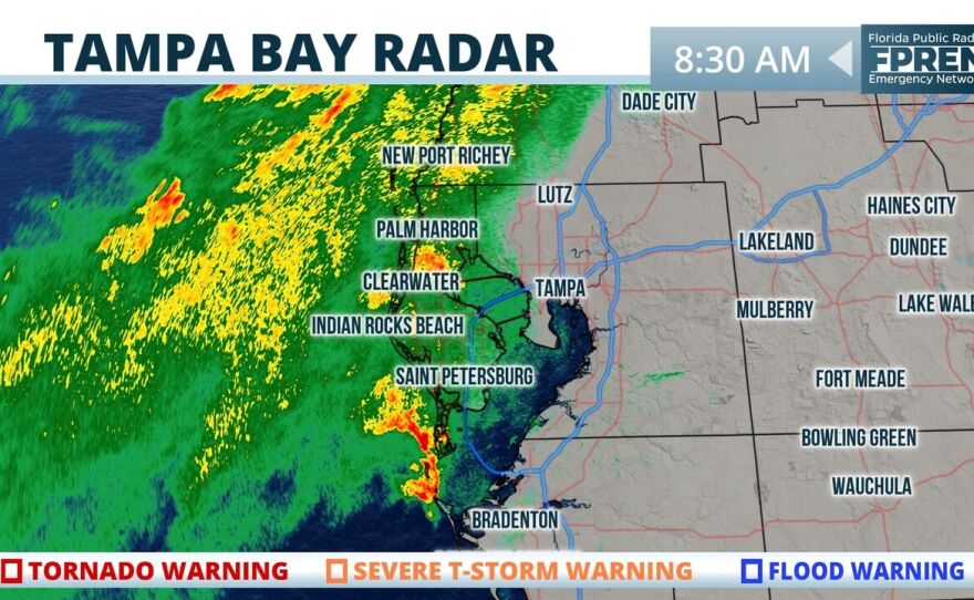
The Tampa Bay area remains under a flood watch as the rain that has saturated the ground and swelled area rivers remains intact.
But a relative end to the soggy conditions could be near.
LIVE RADAR: See where the rain is headed in your area
A stalled frontal boundary to the north, and deep tropical moisture from the Gulf of Mexico, is still in firm control, according to the National Weather Service. This has produced the numerous rounds of soaking rain and potentially heavy downpours this week, as an estimated 3-7 inches of ran has already fallen near the Nature Coast. The trend will continue Friday with a 70 percent chance of showers and thunderstorms that could cause even more localized street flooding – especially in low-lying areas – as well as a high risk of rip currents.
Another 3-6 inches could fall, according to NOAA’s Weather Prediction Center.
ALSO READ: July Set New Global Heat Records, Scientists Confirm
This has prompted the weather service to extend a flood watch across the region into Friday evening – and possibly even longer if the drenching rains persist, forecasters said. Meanwhile, a flood warning has been extended for several rivers – including the Hillsborough, Alafia and Little Manatee – as they remain at flood stage.
A ridge of high pressure over the Atlantic Ocean is forecast to gradually build into central and south Florida Sunday and Monday. As it does, the front will shift northward into Georgia and the winds in the lower part of the atmosphere will gradually become southerly and southeasterly. These two factors should allow for a transition to a more typical pattern of thunderstorms by Monday across the state.
Florida Public Radio Emergency Network meteorologists Ray Hawthorne and Megan Borowski contributed to this report.


