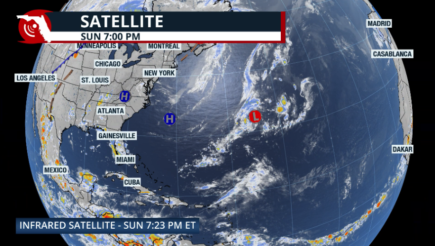
It's been a slow start to the 2025 Atlantic hurricane season, but this does not mean that the season will be slow.
We have not had a system named before the official start to the season since 2021. Perhaps we got used to those hyperactive periods between 2015 and 2021, when there were named systems before June?
ALSO READ: WUSF's 2025 hurricane guide
Many ask if there is any correlation between a slow start and less activity. Unfortunately, the answer is no. The season could pick up, and fast. Most importantly, the signs are there to have a slightly higher than average season, with the National Hurricane Center calling for 13 to 19 named storms.
It is even more important to remember that it only takes one storm or hurricane to hit your area, making it an active and devastating season for you and your loved ones.

Let's talk about 1992. The first storm was Andrew. It was officially named on Aug. 17 as it moved away from Africa. It was a compact but powerful hurricane that struck Miami-Dade County in Florida. It was the first named of the season, over two months after the official start.
Early season forecasts that year were calling for slightly above-average activity, and the updated forecasts decreased the numbers closer to average. That season ended with seven named systems, of which four were hurricanes, and Andrew was the only major category hurricane, a below-average season.
What is it about? How fast could it start?
The eastern Pacific has had an active start. The latest storm to form was Erick, a powerful hurricane that slammed the western Mexican Coast. Along with any current ingredients that might be present, like clusters of storms, surface temperatures of waters, wind shear or any Saharan dust, the outgoing or incoming presence of the Madden-Julian Oscillation could give us a helpful tip to know when there could be an extra impulse of energy in the atmosphere.

The Madden-Julian Oscillation is a tropical cyclical phenomenon that mainly affects subtropics and midlatitudes. It is characterized by enhanced rainfall and cloudiness that moves eastward around the globe; think of it as impulses of energy that take 30 to 60 days to circle the Earth.
So while one region has suppressed rainfall activity, another region is experiencing more rainfall than usual. The energy that travels the world is inconsistent and can increase and decrease even within an impulse.
In recent months, the amplitude of the MJO has seemed relatively low, and it has not played a significant role in potential tropical development in the Atlantic during this cycle. Not having high amplitude or not being present doesn't mean that a system might not form, but having it present could mean extra fuel for a system to develop.

A tropical disturbance is monitored.
The National Hurricane Center gives a low chance for a tropical system to develop from a disturbance over the central northern Atlantic. Even if this system receives a name, it will likely stay a "fish storm" over the open Atlantic waters and not impact the U.S. or the Caribbean. A series of fronts and low pressures will push this area east.

We are still in June, which is very early in the Atlantic hurricane season. We will monitor the tropics closely daily and promptly update you on any disturbances that may form and their possible impacts.


