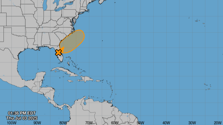
Most of Florida experienced a pretty dry winter and spring. After months of significant drought, the rain has finally arrived. And storms this holiday weekend could provide more relief.
While some areas were fortunate to receive a few inches of rain recently, others had very little.
Now, the National Hurricane Center said there's a chance that a stalled front could become a tropical or subtropical storm. As of 2 p.m. Thursday, the center gives the disturbance a 60% chance of development within seven days, and a 30% chance within 48 hours. It could impact North Florida, the Gulf and maybe the Atlantic in the next week.
Rick Davis, a meteorologist at the National Weather Service in Tampa, said regardless of what happens, the weather front is expected to produce lots of rain and thunderstorms.
"Some areas north of Tampa Bay could see four-to-six inches of rainfall in the next week, and that could coincide with where the worst drought was, in [the] central Nature Coast," he said.
Read more: Sandbag sites are open around the Tampa area to prepare for possible July 4 weekend flooding
Davis said we had a very active rainy season last year, above normal. The year 2024 ended in a surplus of rain, especially after back-to-back hurricanes. But he said, the first five months of 2025 had almost no rainfall to below normal rainfall.
“We had a really wet season followed by a really quick drying. But that's not terribly uncommon… we were just extra rainy last year and extra dry this winter,” he said.

Davis added that high rainfall events followed by severe droughts can be directly linked with long-term climate change effects.
“What we saw the last year with the record rains, the strong hurricanes, and then the quick drought does have some relationship with climate change,” he said. “These more extremes can be expected as we move into the future.”
Much of the state is still under moderate drought conditions, according to the U.S. Drought Monitor.
“The good news is, all the drought conditions are forecast… to continue to ease as we go through the summer, and hopefully we will be out of all drought conditions as we move deeper into the summer,” Davis said.
Despite the 80% chance of showers and storms forecast for the Tampa Bay region on Thursday and Friday, Davis said people can still enjoy their holiday plans this Fourth of July weekend.
Read more: How to celebrate the Fourth of July across the Tampa Bay area
But since we're in the heart of lightning season, he advises: “when thunder roars, go indoors.”
As the rainy season runs through mid-October, Katherine Squitieri, with the Southwest Florida Water Management District, suggests you take advantage of the rainfall this summer to help reduce your water bill.
"Our lawns really only need a half-inch to three-fourths an inch of water every two-to-three days,” she said. “So, when we're getting that more constant rainfall during the summer months, you can actually switch off your irrigation controller, if you have a permanent irrigation system, and wait to turn it on only if you need it."
Squitieri said you should be mindful of water conservation year-round so the supply can recover for the next dry season.
“Water is a limited resource… so, by being more mindful of our water use and conserving water during the rainy season, we're helping to replenish both our groundwater and our surface water supplies, so that when we do go into those drier months, we're at a better place to start,” she said.
Find more information on hurricane evacuation zones, shelters, and preparation tips on our 2025 Hurricane Guide.


