With the arrival of August, hurricane season tends to become more active, with September and October being the months with the most named tropical formations. But where are the most hurricanes in August?
The peak of hurricane season occurs on average on September 10th, and from then on, activity begins to decline.

On average, the peak of hurricane season occurs on September 10.
The first two months of hurricane season, tropical storm formation tends to stay near land, over the Gulf of Mexico, and near the coasts of Georgia and the Carolinas. But it is during August that the favorable zone for hurricane formation expands; it is also the month when more tropical waves exit Africa and travel thousands of miles westward, over the Atlantic Ocean, or those forming in the western Caribbean.
As we approach the peak of hurricane season, tropical activity tends to ramp up in August with more tropical waves emerging from Africa. These are the three historical areas where most storms have formed, and their typical trajectories.
— Florida Public Radio Emergency Network (FPREN) (@FloridaStorms) July 31, 2025
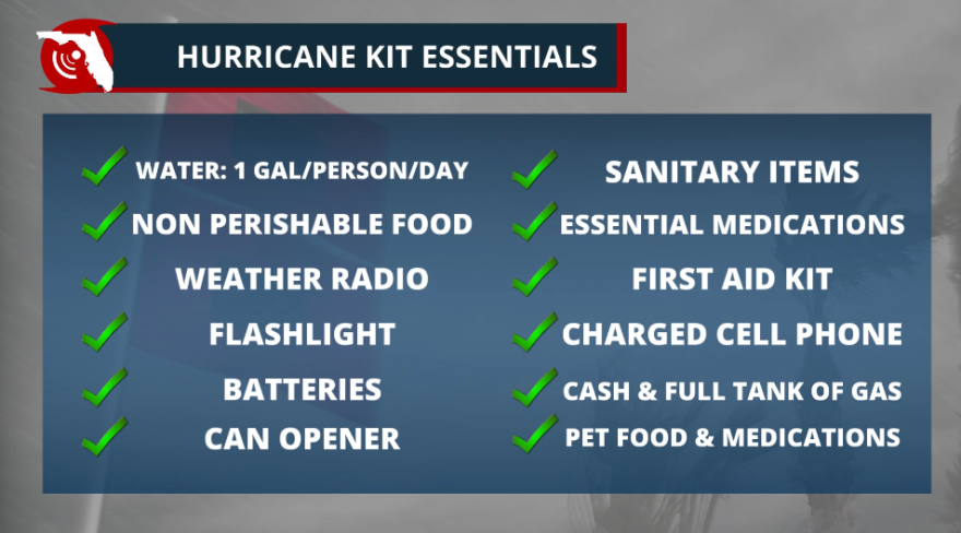
Have a plan. Check your emergency kit. ✅ pic.twitter.com/QLOe8dqRLw
There are three favorable trajectories for tropical waves originating from Africa. The first is the most southerly, traveling through the southern Caribbean to head toward the Gulf of Mexico or the westernmost part of the Caribbean. In these situations, the Mexican coast is the most affected.

The second possible path is further north, that is, over the Caribbean in a westerly/northwesterly direction. They typically impact Florida or the southeastern United States. They are also highly dependent on the Bermuda High. If it is stronger, the storms move further west, with a greater likelihood of impacting Florida, Georgia, or the Carolinas.
Storms that stay over the open Atlantic waters, "fish storms," could impact shipping routes, and if they are large enough, they could increase wave activity along the eastern Seaboard and also elevate the risk of currents.

The third possible path occurs when the Bermuda High is weaker, so it remains further away from the United States. When hurricanes are located north of the Caribbean, they turn north/northwesterly, often without making landfall. Still, there have been some that have had significant impacts on parts of the northeastern United States or southeastern Canada.
HURRICANE KIT ITEMS TO BE PERMANENTLY SALES TAX FREE STARTING AUG. 1

Right now is the time to revise your emergency plans. Do you know if you are in an evacuation zone? What would you do if you got evacuation orders? Is your insurance policy up to date? Would you need extra medicines in case you need to shelter in place for several days? Weeks? Do you know what you would eat if your power goes out for several days and nearby restaurants are closed? Knowing the answers to these questions helps you be prepared and limit stress if a storm threatens or hits your area.


