-
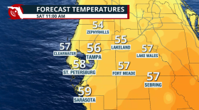 On "Florida Matters Live & Local," meteorologist Megan Borowski of the Florida Public Radio Emergency Network discussed our cold snap and what that means for those heading to Gasparilla and the Stadium Series game at Raymond James Stadium.
 -
 It was the hottest May in decades for Jacksonville and north Florida, with increases in rain.
 -
 A low-pressure system will travel over Florida and bring lots of deep tropical moisture, producing numerous storms, especially across South and Central Florida.
 -
 Slight risk for severe storms to end the week, mainly for North Florida and the Panhandle, then the front moves south.
 -
 It delivers safety alerts and emergency information from official government sources to the public in their native language.
 -
 As summer-like heat builds this week across the Sunshine State, an approaching cold front is expected to result in widespread storms by Wednesday.
 -
 Cost, transportation and mobility can prevent someone from taking action during weather events. While officials and community groups are working to close those gaps, human psychology is also part of the problem.
 -
 Heavy rain, local flooding, strong winds, and isolated tornadoes will all be possible over the peninsula on Thursday.
 -
 The National Hurricane Center said in an update of its products that two-day outlooks will still be available in addition to the new seven-day outlook.
 -
 Gradual improvement to drought conditions are forecast as the rainy season gets started in about six weeks.
 -
 Consistent high temperatures could "accelerate the outset of drought,” says one climatologist.
 -
 Expect breezy conditions across the greater Tampa Bay region before the storms roll in during the early evening.

© 2026 All Rights reserved WUSF
Play Live Radio
Next Up:
0:00
0:00
Available On Air Stations


