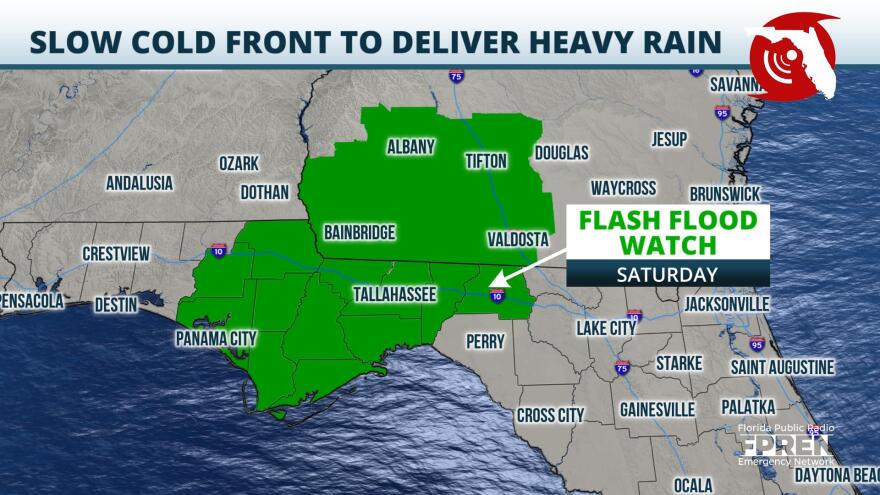
A Flash Flood Watch has been issued for portions of the Florida Panhandle for Saturday ahead of a strong, but very slow moving, cold front.
A cold front on New Year's Day was carving through the western Florida Panhandle delivering rounds of showers and a few isolated thunderstorms to the region. This cold front is expected to continue drifting eastward very slowly Friday night and through Saturday delivering heavy rainfall to central and eastern portions of the Panhandle, including the cities of Panama City and Tallahassee.
Continuous rainfall is expected across the watch area on Saturday as the cold front becomes nearly stationary over the area. Widespread totals of 3 to 4 inches with isolated amounts near 6 inches will be possible.
A trough over eastern Texas will begin to progress eastward late Saturday night and into Sunday morning across the Tennessee River Valley which will allow for the stalled cold front to finally progress eastward towards northern parts of the Florida Peninsula.
Numerous to widespread showers with locally heavy rainfall will continue to shift eastward towards the Atlantic Coastlines for overnight Saturday and into Sunday. Rainfall totals through Sunday morning in northern parts of the Peninsula will generally be less than a half an inch, but widespread amounts of 1 to 2 inches could be possible mainly for inland areas and over towards the Suwannee River Valley, with isolated amounts between 3 and 4 inches possible.
The cold front should progress southward down into Central and South Florida by Sunday afternoon delivering a few scattered showers throughout the area before moving completely off into the Atlantic and away from the Sunshine State late Sunday night. Cooler and drier conditions are expected behind the passage of the cold front to start out the new work week.
Copyright 2021 WUFT 89.1. To see more, visit . 9(MDAyNDY5ODMwMDEyMjg3NjMzMTE1ZjE2MA001))


