

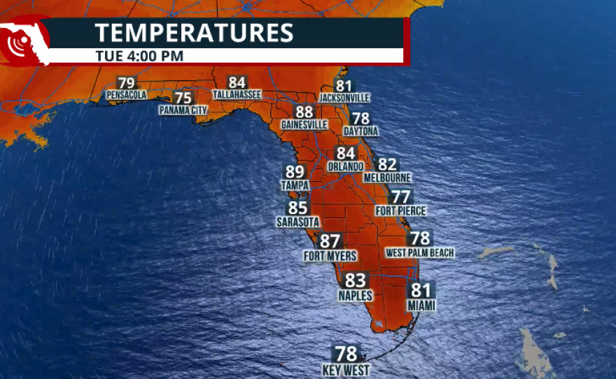
Tuesday will be a transitional day across Florida. While it will be the last cooler morning across North Florida and the Panhandle, temperatures across Central and South Florida will begin to ramp up.
Tuesday morning temperatures will be between 5 and 7 degrees below average for this time of year. But this will be the last morning with "cool" temperatures before it starts getting warm and muggy. Morning temperatures will be on the rise, but also afternoon temperatures
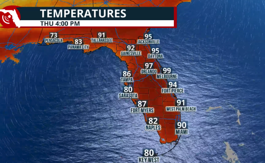
Highs on Tuesday will be hot across Central Florida. Although we are not forecast to reach record temperatures, afternoon highs along the I-4 corridor will likely reach the low 90s. On Wednesday afternoon, a few records could be tied in Leesburg and Winter Haven, where temperatures could approach 95 degrees. Orlando will also be hot, possibly reaching 97 degrees. Along the Space Coast, temperatures could also approach the upper 90s.
Highs will rise across North Florida and the Panhandle, and the change will be more noticeable on Thursday as the winds turn from the south-southwest. Tallahassee's forecast high on Thursday is 91 degrees. Jacksonville's forecast high is 95 on Thursday and Gainesville is likely to hit 92 degrees.


This is all due to a high-pressure system in the middle and upper levels of the atmosphere, which will bring sinking air that warms as it descends. Winds will also contribute to the heat, coming from the southwest and warming as they travel over the interior before arriving hot along Florida’s East Coast.
Onshore winds will keep temperatures warm, but not excessively hot, along the west coast of Florida, ranging between 82 and 86 degrees.
Aside from the heat, rain will also be scarce. The high-pressure system in the upper levels of the atmosphere will suppress rain chances for much of this week, similar to the pattern we experienced late last week into the weekend.
A cold front is expected to move near the Florida Panhandle late Thursday into Friday, likely increasing rain chances along the I-10 corridor. At this time, it appears the front will weaken as it moves south, likely becoming stationary over Central Florida. We will continue to monitor the situation and provide updates on Thursday.


