

High pressure east of Florida will continue the onshore flow across the Sunshine State. However, deep tropical moisture will also continue to move into the region. Some of this tropical moisture is associated with the remnants of what was once Tropical Storm Dolly. Higher-than-normal rain chances will continue through the rest of the week, with the greatest rain chances remaining across the Florida Peninsula through Friday.
Deep tropical moisture is moving into Florida and will keep stormy weather going, especially through the second half of the week. Flash flood risk most of the week for Florida. pic.twitter.com/RN8x7r6R3Y
— Florida Public Radio Emergency Network (FPREN) (@FloridaStorms) September 1, 2026
The heat will continue across the Sunshine State, making the atmosphere unstable. Deep tropical moisture will enhance shower and thunderstorm activity, especially during the afternoon. We will see partly to mostly cloudy skies at the start of each afternoon, with showers and thunderstorms developing quickly and remaining active through the late afternoon and into the early evening. Some of these thunderstorms could produce heavy rainfall in a short amount of time. This could lead to ponding of water and the risk of isolated flash flooding across the state.
For Wednesday, the flash flood risk will remain across the entire Florida Peninsula. In addition, the southern Panhandle, including the Big Bend, has a chance of isolated flash flooding. By Friday, the entire state will be under a Marginal Risk for flash flooding.
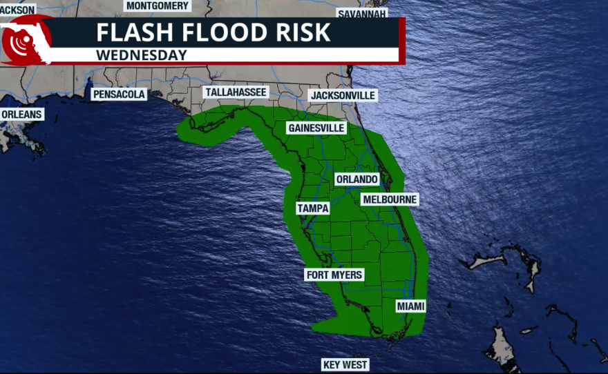
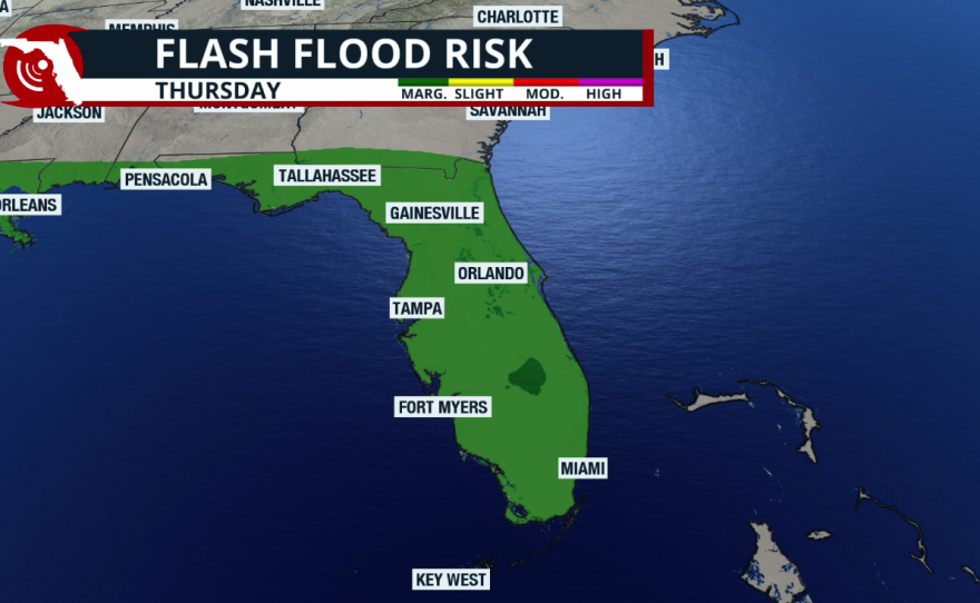
Expect the highest rainfall totals across Central and South Florida. Specifically, rainfall amounts between 5 and 7 inches are possible across parts of the interior of South Florida, extending into Southwest Florida. Areas along the I-4 corridor toward the Tampa area could also receive between 5 and 6 inches of rain over the next five days. Onshore flow will keep rainfall totals slightly lower along the east coast, with amounts generally ranging from 1 to 2.5 inches. Areas east of the I-95 corridor across East Central and Northeast Florida are expected to receive less than 1 inch of rain during the next five days.
Onshore flow will keep most shower and thunderstorm activity confined to the interior and western portions of Florida. Southeast Florida will also receive beneficial rainfall, with widespread amounts between 2 and 4 inches possible, especially across areas east of I-95. Keep in mind that the southeastern suburbs of South Florida could receive locally higher amounts, with isolated locations exceeding 5 inches of rain through Sunday. Rainfall totals could vary sharply over short distances.
Meteorological summer ended with very dry conditions across the Sunshine State.
The Fort Lauderdale area experienced its driest meteorological summer on record, finishing more than 15 inches below normal for the June through August period.

Miami International Airport recorded a rainfall deficit of 14.74 inches during the June through August period, making it the third-driest meteorological summer on record. The Tampa and Naples areas just experienced their fourth-driest meteorological summer on record, while parts of Central Florida, including the Orlando area, recorded their 17th-driest summer on record. Rainfall has increased significantly during the past week, reducing Orlando's rainfall deficit to just under 6.5 inches for the summer season.

Jacksonville recorded a rainfall deficit of 3.36 inches during the same period, making it the ninth-driest meteorological summer on record.
While none of the Panhandle observing stations recorded a top-10 driest meteorological summer, Tallahassee experienced its 21st-driest summer on record, with a rainfall deficit of about 5 inches.
According to the latest draft report released on August 27, 2026, drought conditions worsened across Florida in every category. Extreme drought expanded by nearly three-quarters of a percentage point, while abnormally dry conditions increased by almost 2%.

The next U.S. Drought Monitor report will be released on Thursday, September 3. Keep in mind that the data cutoff was Tuesday morning, September 1. Therefore, any rainfall that falls across Florida during the second half of the week will not be reflected in this upcoming drought report.


