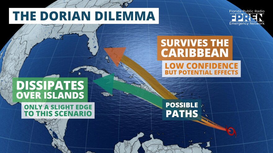
Tropical Storm Dorian will face numerous challenges on its journey through the Caribbean in the coming days.
Potential effects from Dorian in Florida are highly uncertain, especially considering how many unknowns there are in the forecast at this time.
As of the 11 am advisory from the National Hurricane Center, Tropical Storm Dorian was located 135 miles east-southeast of Barbados, and moving west-northwest at 14 mph. Tropical storm conditions are expected to arrive in the Windward Islands Monday evening, and Dorian could become a hurricane as it approaches Puerto Rico.

The National Hurricane Center has expressed “ higher than usual uncertainty” in recent forecasts for Tropical Storm Dorian. Hurricane specialist John Cangialosi said the cyclone was “challenging to predict” due to its compact size in his Monday morning forecast discussion. Small storms can sometimes erratically fluctuate in intensity, as they are more likely to be influenced by smaller changes in their environment.
Forecast data suggests Dorian will navigate through a complex array of factors over the next five to seven days. Most are likely to inhibit development.
First, gradual strengthening is expected by the National Hurricane Center over the next 36 hours. This is primarily attributed to warm sea surface temperatures and marginally favorable upper level winds over the eastern Caribbean. Pockets of dry air have been recently noted on the periphery of the system, and this may temporarily delay intensification, but Dorian is still forecast to briefly become a hurricane near Puerto Rico Wednesday.
Wind shear is a term used to describe a changing of wind speed or direction with height. When the shear is high, it can keep a tropical storm from maturing or cause it to dissipate. Higher amounts of wind shear are projected by several reliable forecast models ahead of Dorian’s likely path near the Greater Antilles. Timing is critical though, because these areas of stronger winds aloft are also on the move. If Tropical Storm Dorian arrives sooner or later than the projected wind shear, it may have little effect on the storm’s structure or intensity.
Interactions with land are also a major detriment to a tropical cyclone’s development. Multiple obstacles - islands in this case - lie in Dorian’s potential path. The large and mountainous island of Hispaniola, for example, has long been a graveyard for tropical systems. A path directly over the island would likely disrupt the storm’s circulation and result in weakening, or even dissipation. If Tropical Storm Dorian were to move between two islands, or just brush by one of them, the storm would have a better chance of staying in tact.
There is a chance, albeit a low one at this point, that Tropical Storm Dorian could affect Florida. However, it has to survive its journey to the north side of Hispaniola first. If that were to occur, long range forecast models then suggest the remnant circulation would enter an environment more favorable for intensification, and it could potentially approach the peninsula late this weekend.
While it is far too early to make a credible forecast centered around such outcome, we encourage all Floridians to stay informed of future forecasts on Tropical Storm Dorian in the coming days.
Copyright 2020 WUFT 89.1. To see more, visit . 9(MDAyNDY5ODMwMDEyMjg3NjMzMTE1ZjE2MA001))


